KC Bike Plan Research
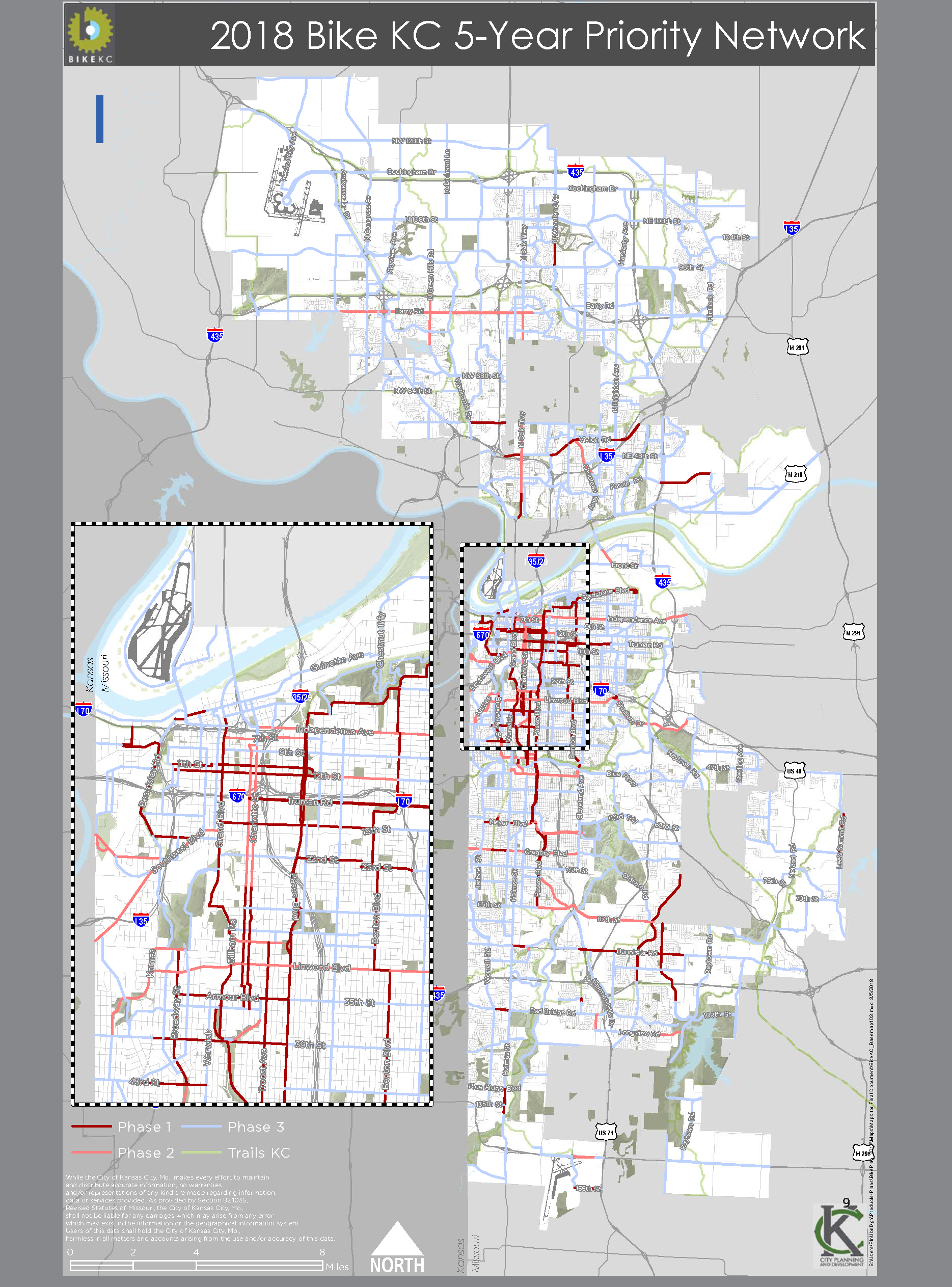
The process began by attending Bike infrastructure meetings with planning staff and citizens. From these meeting feedback was recorded and digitized. GIS maps were created based on the feedback given displaying existing bike lanes, road conditions, and demands of cyclists. The combined information was used to show the necessary updates to the bicycle infrastructure. The final step was to narrow down the information given, and developed maps and planning recommendation from the feedback and observations.
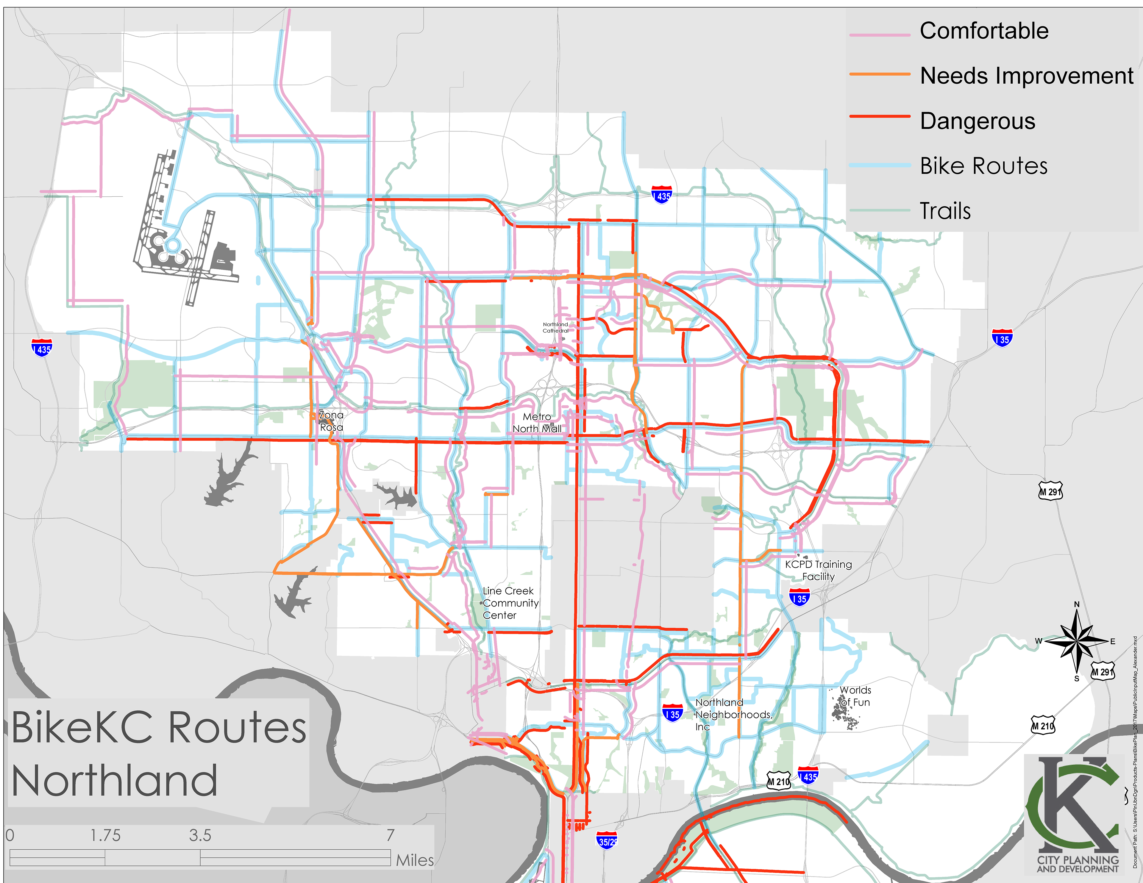
Labelled citizen’s responses as: Comfortable, Needs Improvement, or Dangerous. Then juxtaposed the input with existing bicycle infrastructure.